Showing posts with label mountains. Show all posts

Tuesday, May 29, 2018

NOLS Professional Instructor Course


The primary purpose of this course is to train and evaluate potential NOLS instructors who already have extensive experience teaching in the outdoors. 

Each participant’s skills and abilities are assessed and evaluated by the course instructors with the intent of determining their potential as an instructor. 

On this course, participants will develop and refine the teaching and leadership skills needed for professional positions at NOLS.

This course is conducted in Wyoming’s Wind River Range. Because the environment and terrain are representative of many NOLS programming areas, the Winds are ideal for introducing NOLS' field practices. 

The course includes three components: a three-day leadership module taught in town, an eight-day backpacking expedition, and a three-day section of top rope rock climbing training.

Go to: www.nols.edu

Wednesday, November 11, 2009

MLTW Course Providers Workshop


One of the benefits of being a MLTW course provider for the Climbing Wall Award and Single Pitch Award is that I am able to attend networking events such as the recent workshop organised by Bryn Williams (MLTW) and Mal Creasey (MLTE) which was hosted at Plas Caerdeon near Barmouth.


As with all these events, it is a much about catching up with peers, colleagues and old friends as it is to learn about changes in policy and procedures. It is also a useful forum for asking questions and seeking clarification on matters of course delivery and paperwork.


In the afternoon, the day took a more educative turn with John Roberts from the Snowdonia National Park, where he works as their Archeologist, who walked us through an area around Egryn Abbey were he talked about bronze and Iron age settlements and burial grounds. It was not only stimulating in itself but relevant and useful for course providers as added information for their course participants.


........and finally, what would be a good collective noun for a group of mountain skills trainers and assessors?

Wednesday, January 21, 2009

Navigation - Grid References


Considering their importance in navigation, grid references are comparatively simple. First of all, what are they? Grid references are a numerical system of identifying a given point on a map. The numbers (when used with the right map) are applicable to only one area on that map.

A four figure grid reference will give a position within a kilometre square. This, though useful, is often too big. So generally navigators go further and use six figure references which brings the area down to a 100 metre square.

How do they work? There are a few rules to remember when using a reference. Get them right and there should be no more problems. The numbers, when referred to, identify a grid line on the map.

So first and foremost find the number along the bottom of the map and identify the grid line - Eastings. Then look for the number up the side - Northings. Run a finger up the vertical line and one along the horizontal line until they meet. That should put you at the intersection of two lines forming a cross. Now, which of the four squares do the numbers relate to ? This is the second rule. When using the numbers along the bottom look to the right of the vertical line. when using the numbers on the side look above the horizontal line, at the intersection.

The same rules apply to the six figure grid references. One additional rule is that the first column on the left is zero and the last column is nine. The bottom row is zero and the top row is nine.

Wednesday, January 14, 2009

Navigation - The National Grid


The National Grid is a system of squares devised to enable the map makers to have a point of reference, although it is imaginary, to create an index system allowing parts of the country to be identified. This is different from using latitude and longitude.

This National Grid System consists of a frame of 100 kilometre squares laid over the Ordnance Survey Maps of Great Britain. Each 100 km square has a two letter code and is numbered 00 to 99 from West to East and from South to North. It is important to realise that a six figure reference will appear every 100 km and it is essential to quote the two letter prefix will refer to a square (see image).

Beyond knowing that the National Grid System exists and how to order maps using it, the average hill walker and navigator will have very little need of any additional information.

Wednesday, January 07, 2009

Navigation - The 6 Principles


Destination
- Where do you want to go?

Direction
- Which way are you going?

Distance
- How far is it?

Duration
- How long will it take?

Description
- What will we see on the way and when we get there?

Demonstrate
- Can you show this is the right place now you are here?

Wednesday, February 27, 2008

Llanberis Mountain Film Festival

Make sure you don't miss the fourth Llanberis Mountain Film Festival over the weekend of 7th to 9th March ! LLAMFF 2008 promises a wild and wonderful programme of films, talks, mountain sculpture, Art and even food, with contributors from Wales and beyond, capturing the spirit of adventure and celebrating mountain Art, sport and culture worldwide. The festival ticket allows you unlimited access to a large and diverse range of events, from screenings of short listed entries to the second LLAMFF international film competition including a number of premiere screenings, talks by local and national climbing celebrities and other adventurers, a selection of award-winning films including world premieres, and much, much more. Full details of the inspiring festival programme have been added to the website.

Monday, January 21, 2008

Scottish Avalanche Information Service

This has become an invaluable service for mountaineers, off-piste and touring skiers


The Scottish Avalanche Project began in 1988 as a forecasting service funded by the Scottish Sports Council and operating in 2 areas, Glencoe and the North Cairngorms. This ran for 2 winters, with the addition in 1989-90 of Lochaber and a weekend pilot scheme on Lochnagar. After this the Project was permanently adopted by the Scottish Sports Council and became the Scottish Avalanche Information Service


Fortunately, the website was continued and with the addition of South Cairngorms and Creag Meagaidh in winter 1996-97 and the re-naming of the Scottish Sports Council, the operation became the sportscotland Avalanche Information Service. This is the form in which the service continues today. The website has grown to become the main source of dissemination of the Snow and Avalanche Reports, with over 3,000 visits on a busy winter's day


There are now blogs for the regions as well

Wednesday, December 05, 2007

Backcountry Skiing vs. Ski Mountaineering


Backcountry skiing" is a term that is familiar to almost every skier, yet "ski mountaineering" remains a bit of a mystery to many. Simply stated, ski mountaineering is the use of skis for ascending and descending mountains. The "skis" used could be either specialised ski mountaineering gear (alpine touring / randonee), standard downhill skiing gear, telemark gear (free-heel nordic), very-short figle skis, or even snowboards. In the purest form of ski mountaineering, both the ascent and descent of a peak are made entirely on skis, using climbing skins and perhaps ski crampons for traction on the ascent, and then descending a continuous ski route back down to the base. At times a complete ski ascent is not possible due to snow conditions, route selection, or equipment choice, thus requiring some climbing on foot, perhaps using crampons or snowshoes. In other cases, a continuous ski descent may be dangerous or impossible, requiring downclimbing or abseiling past the areas of difficulty. The goal of ski mountaineering is to use skis to enhance the overall mountaineering experience by increasing speed, efficiency, and (most of all) enjoyment in the mountains.


In contrast, backcountry skiing usually refers to skiing for its own sake, trying to find the best ski conditions and terrain regardless of the particular mountains where it occurs. Although the ascent and descent techniques are the same, the goals of ski mountaineering trips and backcountry skiing trips are usually different. Backcountry ski trips typically involve yo-yoing a single slope several times in one day once the good snow has been found, while ski mountaineering trips typically consist of a single focused ascent or traverse each day. Most ski mountaineers do either style of trip depending on which is appropriate for the conditions and the season.


Tuesday, January 02, 2007

Summits & Solitude


Ben Nevis
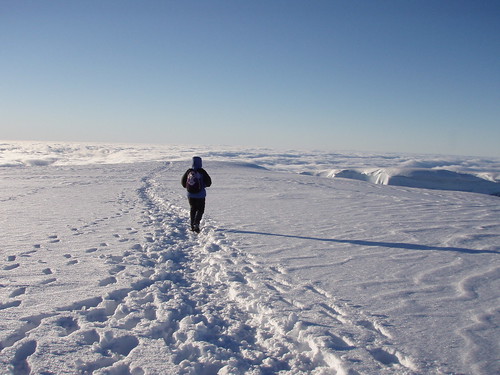
Though the current focus of my life is sea kayaking, I have in fact been a mountaineer and climber far longer. Despite the issue that more of me hurts after a day in the hills than after a kayaking trip, its still good to get out there from time to time. As part of our christmas vacation, Tanya and I spent 5 days near Fort William where an ascent of Ben Nevis (1344 metres) is obligatory, especially when its snow covered. So we opted for an alpine start as the climb begins from almost sea level, if you do it via the Pony Track. This saw us first on the mountain, from the Glen Nevis side, and the rare experience of seeing not another sole all the way to the summit. The conditions underfoot were good and after we crossed the Red Burn, the weather cleared giving way to gorgeous views towards Cairngorm and Torridon. Its not every day you get a major UK summit free of crowds but on that day we were gifted. It was only in descent did we begin to come across others, some who had climbed on the north face and some who had set off later

I enjoy those moments of solitutude............ it seems they come round less and less

Saturday, March 25, 2006

Mark Tozer - Expedition Leader


Mark is a seasoned expedition leader with a breadth of global travel experience in the mountains and on the sea

If you are need the expertise to get a trip off the ground or require that extra element of safety cover, you should think about getting in touch

Countries that Mark has been to that he can advise on include: Greenland, Norway, Morrocco, Tanzania, Kenya, Ecuador, Alaska, Baja and across Europe

Friday, March 24, 2006

Mountain Instruction

Mark can provide guided rock climbing, scrambling or hill walking trips in the Snowdonia mountains or further a field in the UK for individuals or small groups, whatever the season.

If you wish to improve your climbing performance Mark can create a workable coaching programme that will go towards developing better technique and more robust skills.

Mark is able to offer specialist skills development courses in mountaineering and rock climbing. These one, two or five day programmes focus on: 

• The Fundamentals of Mountaineering – Summer & Winter 
• Map and Mountains
• Scrambling & Beyond
• The Fundamentals of Climbing
• The Vertical Dance
• Safety, Rescue and Recovery for Climbers

Most of the training Mark can provide is bespoke and is tailored around people’s exact needs and timescales. Courses and coaching address all ability ranges from complete beginner to experienced practitioners.

Mark is also in a position to offer MLTUK training and assessment courses for:

Sunday, March 19, 2006

Certifications & Credentials


Mark is certified and credentialed in the following areas:

Urban Emergency Medicine


NREMT - Emergency Medical Technician

NREMT - Emergency Medical Responder

ABA - Advanced Burns Life Support Provider

AHA - Basic Life Support Provider

AHA - Advanced Life Support Provider

AHA - Pediatric Life Support Provider

AHA - Neonatal Resuscitation Provider

Wilderness Emergency Medicine

NOLS - Wilderness Emergency Medical Technician

NOLS - Wilderness First Responder

NOLS - Wilderness First Aid

REC - Emergency First Aid

WMT - Far From Help

On The Water

BCU - Level 5 Coach (Sea)

BCU - Level 3 Coach (Inland)

BCU - Level 3 Coach (Canoe)

RYA - Safety Boat Handler

WRI River Rescue Technician

In the Mountains

Leave No Trace - Master Educator

MLTUK -
Mountain Instructor Award

MLTUK - Winter Mountain Leader

In The Classroom

Mark has also obtained a number of academic accolades:

Doctor of Philosophy - The Leadership Pathway

Accredited Practitioner of the Institute for Outdoor Learning

Fellow of the Royal Geographical Society

Fellow of the Higher Education Academy


NAEMT GEMS Instructor

NAEMSE Level 1 Instructor Course

Post Graduate Certificate of Education - Secondary Education

Post Graduate Certificate of Education - Higher Education

Post Graduate Certificate of Education - Experiential Learning

Wyoming OEMS Course Coordinator - EMR & EMT